Kids, School, and Safety
Every morning, five days a week, almost 50,000 Lincoln students throw on their backpacks, grab a snack and head out the door for school. Many are excited to see their friends and go to their scheduled classes and activities. Whatever their schedule might be, Lincoln Transportation and Utilities’ (LTU) goal is to provide walking routes to get them there safely each day.

Walking Routes Defined
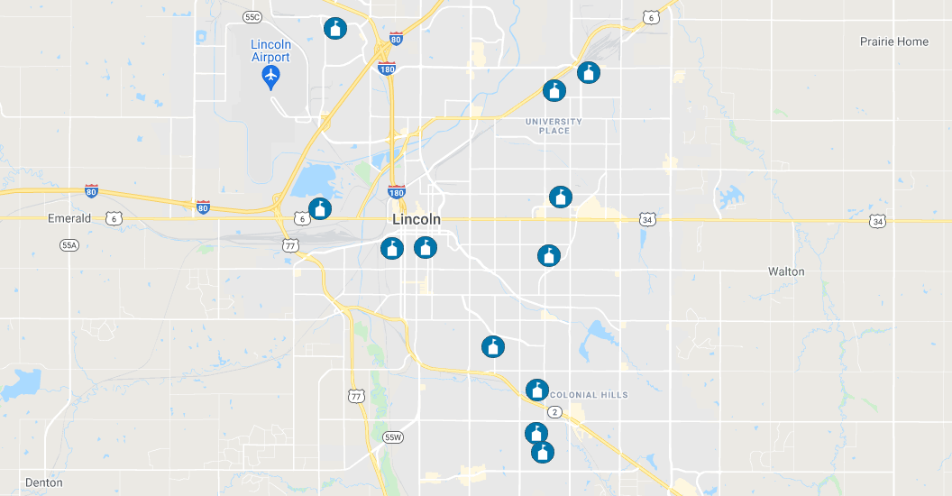
If you have been working to figure out the best walking route to school for your student, so is LTU. LTU has developed an online map to easily guide students on the safest routes to and from school. Twelve school walking routes have been identified as a part of Lincoln’s school zone improvement project. The project will help Lincoln meet national school zone standards through the next several years. Once evaluated, additional school zone walking routes will be created for all schools in the city and added to the online map.
‘Primary walking routes’ have been developed for these initial twelve schools:
- Humann Elementary, 6720 Rockwood Lane
- St. Peter Catholic, 4500 Duxhall Drive
- Rousseau Elementary, 3701 South 33rd Street
- Dawes Middle, 5130 Colfax Avenue
- St. Patrick Catholic, 4142 North 61st Street
- Pound Middle, 4740 South 45th Street
- Lakeview Elementary, 300 Capitol Beach Boulevard
- Culler Middle, 5201 Vine Street
- Fredstrom Elementary, 5700 NW 10th Street
- Park Middle, 855 South 8th Street
- Lefler Middle, 1100 South 48th Street
- McPhee Elementary, 820 Goodhue Boulevard
Check these schools out at lincoln.ne.gov/SchoolWalkingRoutes
Safety: Always A Priority
The increase in population and urban sprawl means more traffic and mixed use of Lincoln’s streets. This is where LTU jumps into action. Eighty-four public and private schools are slated to be assessed to determine what changes and improvements are needed in each school zone.
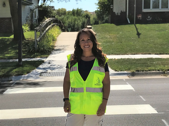
“I, myself, have children in school and I want them to get there safely. I am extremely grateful to be a member of the Traffic Engineering team to ensure all school zones provide students safe travels to and from school. Primary walking routes and critical infrastructure is our priority.”
– Melissa Ramos-Lammli
LTU Senior Traffic Technician
School Zone Improvements
Updates to school zones can include but are not limited to pavement markings, parking updates, speed limit changes, traffic warning flashers, and curb ramps. All required changes and improvements will be handled by LTU staff as funding allows. “Our school zone improvement project ensures Lincoln meets national school zone safety standards and provides the safest walking path to school for students,”
said Dan Carpenter, Lincoln Transportation and Utilities Engineering Service Manager. “This project will be coordinated with other construction projects and schools to lessen disruptions in the area.”
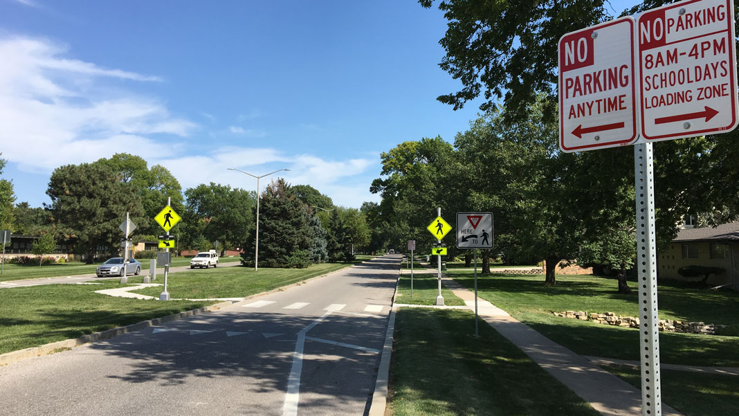
Crosswalk markings and signing will also be updated in school zones. Residents will eventually see established ‘primary walking routes’ for all schools in Lincoln. The online map is a quick and convenient tool to assist parents and students with a safe route to and from school.
For more information on the school zone safety map and the school zone improvement project standards, visit lincoln.ne.gov/SchoolZone.